One Trip, Three Ways to Move: Inside Tampere's Surprisingly Simple Multimodal Transit Life
Let's say you're staying near Tampere's city center and you need to get to Hervanta — a lively district southeast of downtown that's home to Tampere University's tech campus and a dense residential neighborhood. You could take the tram directly. Or you could grab a city bike, pedal to the nearest transit stop, lock up, ride the bus, and then walk the last few blocks through a well-lit, well-signed pedestrian network to your exact destination.
Here's the wild part: that second option doesn't feel harder. It feels just as natural.
That's the thing about Tampere's approach to getting around. It's not that any single mode of transport is exceptional on its own — it's that they all fit together like puzzle pieces someone actually tried to match up. For American visitors accustomed to cities where biking, transit, and walking each operate in their own separate universe with their own separate logic, Tampere's integrated system can feel almost disorienting in the best possible way.
What "Integrated" Actually Means Here
The word "multimodal" gets thrown around a lot in American urban planning circles, usually to describe a city that has both a bus route and a bike lane somewhere in the same zip code. Tampere means something more literal by it.
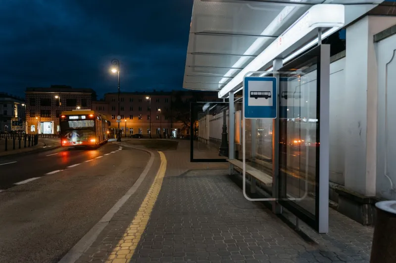
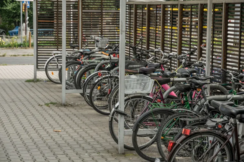
At most major transit stops, you'll find covered bike parking — not just a single rusty rack bolted to a pole, but actual structured shelters with enough space to handle real commuter volume. The city's bike-share network, Tampere Pyörät, has stations positioned deliberately near bus and tram stops rather than just wherever a parking lot used to be. The tram itself was designed with bike storage in mind. And the pedestrian paths that connect transit stops to surrounding neighborhoods are maintained, mapped, and lit with the same seriousness as the roads.
This isn't accidental overlap. It's the result of city planners asking a question that sounds obvious but rarely gets answered in practice: when someone finishes their bus ride, where are they actually going, and how do we make that last part easy?
A Real Journey Worth Walking Through
Consider what a typical combined trip looks like for a Tampere resident on a weekday morning. She lives about two kilometers from the nearest tram stop — close enough to bike, far enough that walking every day would eat into her schedule. She grabs her personal bike (or a city share bike if she's left hers elsewhere), pedals along a dedicated cycling path that runs parallel to a main road but physically separated from traffic, locks up at the sheltered rack adjacent to the stop, taps her transit card, and boards the tram.
At no point did she consult three separate apps. At no point did she wonder whether her bike would be safe or whether there'd be space to lock it. At no point did she stand on an unmarked corner trying to figure out if the bus had passed or just hadn't arrived yet. The whole thing just... worked.
Now compare that to a similar trip in a mid-sized American city. The bike lane disappears two blocks before the transit stop. The transit stop itself is a signpost on a curb with no shelter and no bike infrastructure nearby. The bus app and the bike-share app are completely separate platforms with no integration. And if she wanted to bring her bike on the bus, she'd need to fold it, or hope there's room on the rack, or just not bother.
The friction in the American version isn't dramatic. It's just constant. And constant friction is what eventually convinces people to drive.
The Pedestrian Piece Nobody Talks About Enough
Cycling and transit tend to get the most attention in multimodal conversations, but Tampere's pedestrian infrastructure is doing serious work in this system and doesn't get nearly enough credit.
The walking paths here aren't just sidewalks. They're intentional connectors — routes that link transit stops to parks, residential areas, shopping, and services in ways that feel considered rather than incidental. Wayfinding signage is consistent and human-scaled, meaning you can actually read it while walking at a normal pace rather than stopping to squint at something clearly designed for drivers.
For visitors especially, this matters enormously. One of the most disorienting experiences in an unfamiliar city is stepping off a bus or train and having no idea which direction leads to where you're going. In Tampere, that moment of confusion is genuinely brief. The environment itself gives you cues.
Why American Cities Keep Getting Stuck
The honest answer involves money, politics, and infrastructure legacy — but a big part of it is also siloed thinking. In most American cities, the transit authority, the cycling program, and the public works department managing sidewalks are separate entities with separate budgets and separate planning cycles. They coordinate occasionally. They share goals rarely.
Tampere's mobility planning operates from a more unified framework, one where the goal isn't just to provide transit, or just to build bike lanes, but to reduce the total friction of getting from any point A to any point B without a car. That's a subtly different mandate, and it produces subtly different decisions at every level.
It also helps that Tampere is a city of around 250,000 people — large enough to have real transit demand, compact enough that a connected network is physically achievable without the complexity that paralyzes larger metros. But scale isn't the whole story. Plenty of American cities in that same population range haven't cracked this. The difference is intent.
What Visitors Should Actually Do
If you're visiting Tampere and you want to experience the multimodal network rather than just read about it, the advice is simple: don't plan around a single mode. Download the Nysse app (Tampere's regional transit platform), grab a day pass, find a city bike station near your accommodation, and just move. Take the tram somewhere, walk back a different route, bike to lunch.
The system is forgiving in a way that rewards experimentation. Miss a tram? The next one's coming. Unsure where to lock your bike? There's almost certainly a rack near the stop. Need to switch from biking to walking because the weather shifted? The pedestrian paths are right there.
For Americans accustomed to treating every trip as a logistical puzzle requiring advance planning, the freedom in that is genuinely refreshing. Tampere has done the planning work so you don't have to — and that, more than any individual infrastructure feature, is what makes the whole thing feel like it belongs to a different era of city-building than most of us grew up in.